File:1885 Map.jpg
From Historical Hastings

Size of this preview: 1,280 × 821 pixels. Other resolutions: 320 × 205 pixels | 2,403 × 1,542 pixels.
Original file (2,403 × 1,542 pixels, file size: 1.37 MB, MIME type: image/jpeg)
Summary[edit]
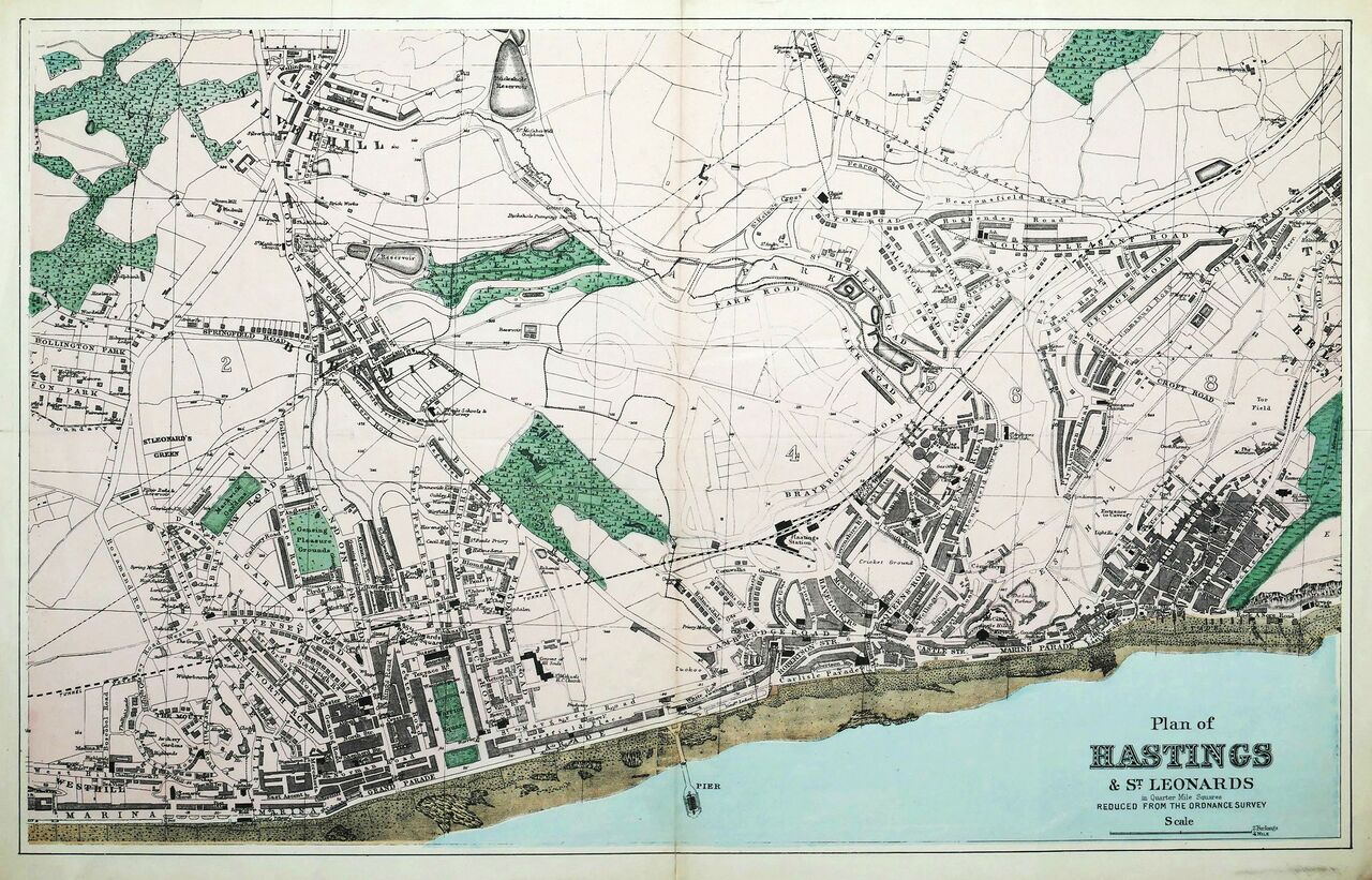
| Description | English: 1885 Map of Hastings & St. Leonards |
| License Date | 1885-05-05 |
| Source | Own work |
| Author | Roy Penfold |
Licencing[edit]
File history
Click on a date/time to view the file as it appeared at that time.
| Date/Time | Thumbnail | Dimensions | User | Comment | |
|---|---|---|---|---|---|
| current | 01:03, 15 March 2022 | | 2,403 × 1,542 (1.37 MB) | RoyPenfold (talk | contribs) | Uploaded own work with UploadWizard |
You cannot overwrite this file.
File usage
The following page links to this file: