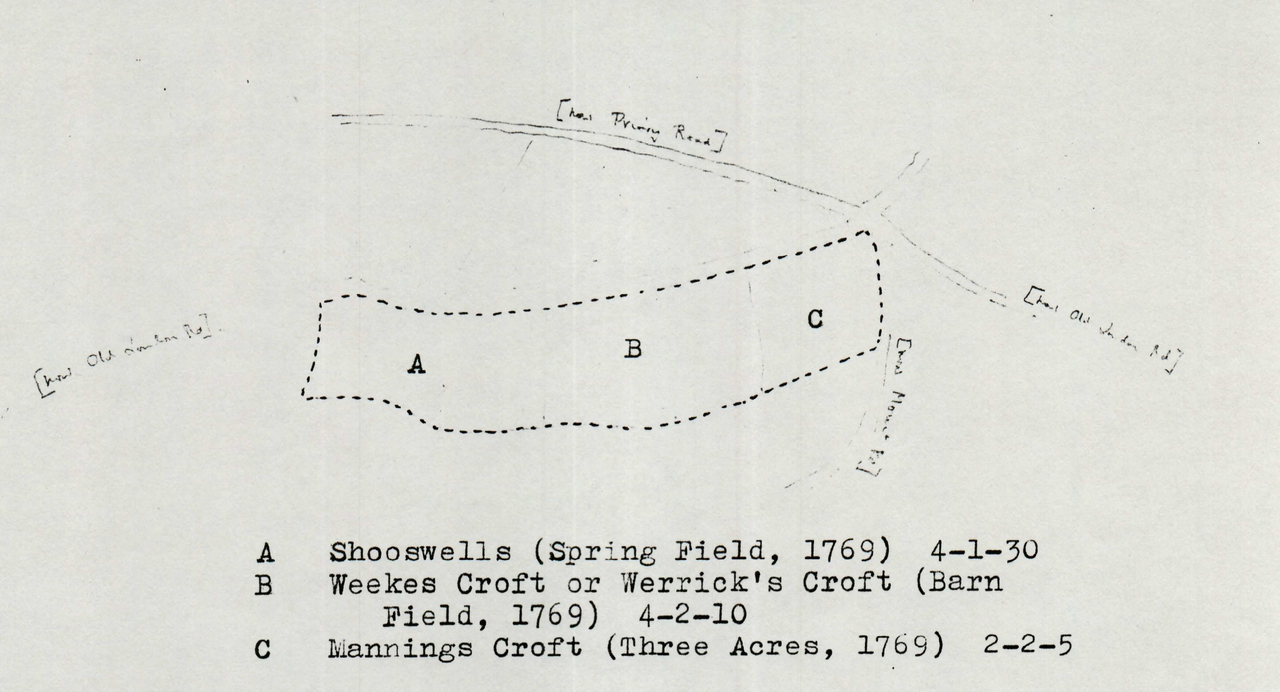
File:Map showing make-up of Pauls Field.png
From Historical Hastings

Size of this preview: 1,280 × 692 pixels. Other resolutions: 320 × 173 pixels | 4,312 × 2,332 pixels.
Original file (4,312 × 2,332 pixels, file size: 3.76 MB, MIME type: image/png)
Pauls field map 1769
Source[edit]
Histories of Hastings' Houses and Properties in three volumes: J. Manwaring Baines - Hastings Museum and Art Gallery
File history
Click on a date/time to view the file as it appeared at that time.
| Date/Time | Thumbnail | Dimensions | User | Comment | |
|---|---|---|---|---|---|
| current | 16:02, 11 March 2020 | | 4,312 × 2,332 (3.76 MB) | Royp (talk | contribs) |
You cannot overwrite this file.
File usage
The following page links to this file: