File:Plan of route for The Bourne.png
From Historical Hastings

Size of this preview: 1,280 × 457 pixels. Other resolutions: 320 × 114 pixels | 1,708 × 610 pixels.
Original file (1,708 × 610 pixels, file size: 470 KB, MIME type: image/png)
Summary[edit]
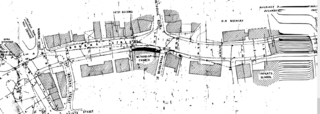
| Description | English: |
| License Date | 1967-05-05 |
| Source | Hastings Borough Council Planning application ref HS/67/00670 |
| Author | E. Baxter Borough Engineer |
Licencing[edit]
{{subst:uwl}}
File history
Click on a date/time to view the file as it appeared at that time.
| Date/Time | Thumbnail | Dimensions | User | Comment | |
|---|---|---|---|---|---|
| current | 19:03, 22 May 2023 | 1,708 × 610 (470 KB) | RoyPenfold (talk | contribs) | Uploaded a work by E. Baxter Borough Engineer from {{HBCPlanning|HS/67/00670}} with UploadWizard |
You cannot overwrite this file.
File usage
The following 3 pages link to this file: