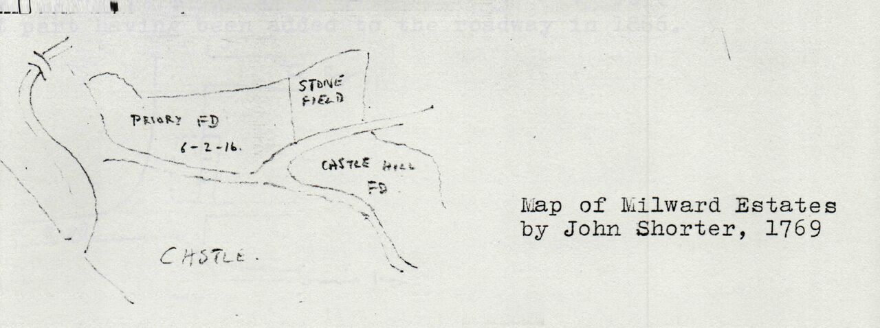
File:WestHill.MilwardEstates Shorter Map of 1769.jpg
From Historical Hastings

Size of this preview: 1,280 × 478 pixels. Other resolutions: 320 × 119 pixels | 7,504 × 2,800 pixels.
Original file (7,504 × 2,800 pixels, file size: 1.12 MB, MIME type: image/jpeg)
John Shorter Map of Milward Estate 1769, showing West Hill Fields
File history
Click on a date/time to view the file as it appeared at that time.
| Date/Time | Thumbnail | Dimensions | User | Comment | |
|---|---|---|---|---|---|
| current | 19:49, 4 March 2020 | 7,504 × 2,800 (1.12 MB) | Royp (talk | contribs) |
You cannot overwrite this file.
File usage
The following page links to this file: