File:Briars Estate Map from Brochure.jpg
From Historical Hastings

Size of this preview: 779 × 1,024 pixels. Other resolutions: 182 × 240 pixels | 1,558 × 2,048 pixels.
Original file (1,558 × 2,048 pixels, file size: 1.04 MB, MIME type: image/jpeg)
Summary[edit]
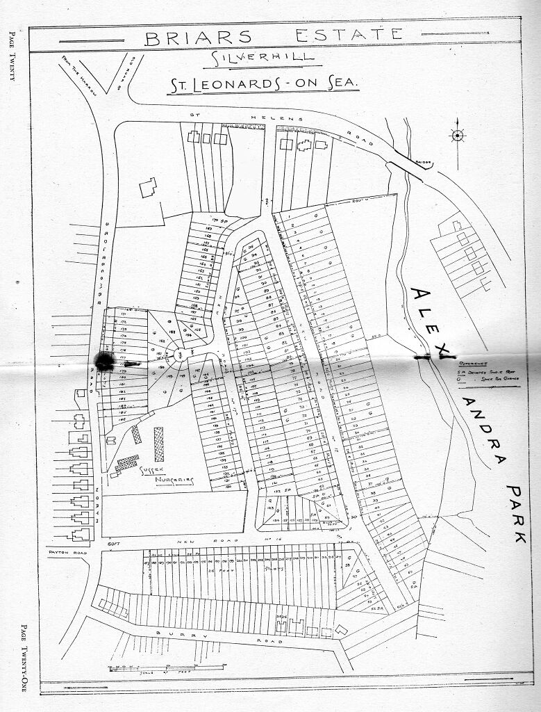
Map from brochure showing roads constructed as part of the Briars Estate Circa 1937
Source[edit]
Ian Shiner via Historical Hastings Facebook Group
File history
Click on a date/time to view the file as it appeared at that time.
| Date/Time | Thumbnail | Dimensions | User | Comment | |
|---|---|---|---|---|---|
| current | 15:09, 27 June 2019 | | 1,558 × 2,048 (1.04 MB) | Royp (talk | contribs) | == Summary == Map from brochure showing roads constructed as part of the {{Visible|Briars Estate}} {{Circa|1937}} {{VH|King Edward Avenue}}{{VH|Briars Avenue}}{{VH|Madeira Drive}} == Source == Ian Shiner via Historical Hastings Facebook Group |
You cannot overwrite this file.
File usage
The following 4 pages link to this file: